MATLAB Basemap Data - grayland
178 Downloads
Updated09 Mar 2022
Editor's Note:This file was selected as MATLAB Central选择的Week
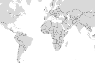
Two-tone map with gray land and white water, overlaid with boundary lines, made with Natural Earth.
Size: 40 MB
Zoom levels: 0 to 7
This basemap can serve as the background for plots of geographic data, created with functions like geobubble. For more details on accessing basemaps, please visit://www.tatmou.com/help/matlab/creating_plots/access-basemaps-in-matlab.html
Opening the .mlpkginstall file from your operating system or from within MATLAB will initiate the installation process for the release you have.
This .mlpkginstall file is functional for R2017b and beyond.
MATLAB Release Compatibility
Platform Compatibility
Windows macOS LinuxCategories
Tags
Community Treasure Hunt
Find the treasures in MATLAB Central and discover how the community can help you!
Start Hunting!Discover Live Editor
Create scripts with code, output, and formatted text in a single executable document.
You can also select a web site from the following list:
Americas
- América Latina(Español)
- Canada(English)
- United States(English)
Europe
- Belgium(English)
- Denmark(English)
- Deutschland(Deutsch)
- España(Español)
- Finland(English)
- France(Français)
- Ireland(English)
- Italia(Italiano)
- Luxembourg(English)
- Netherlands(English)
- Norway(English)
- Österreich(Deutsch)
- Portugal(English)
- Sweden(English)
- Switzerland
- United Kingdom(English)
Asia Pacific
- Australia(English)
- India(English)
- New Zealand(English)
- 中国
- 日本Japanese(日本語)
- 한국Korean(한국어)